About Australian Bush Life
Australian Bush Life is here to document and display some of the beauty of the natural Australian bush and its amazing plants and animals as a vehicle to educate and promote conservation and bush recovery.
It is also here to let you take time out and step into a bush world.
The flora and fauna documented on this site are from the beautiful Clarence valley on the north coast of NSW and particularly a property, Istari, north west of the regional centre of Grafton, and a part of the magnificent Clarence River valley, one of the largest rivers of east coast Australia.
The land, 'Istari', is on Bundjalung country. The Bundjalung people are the traditional custodians of this land.
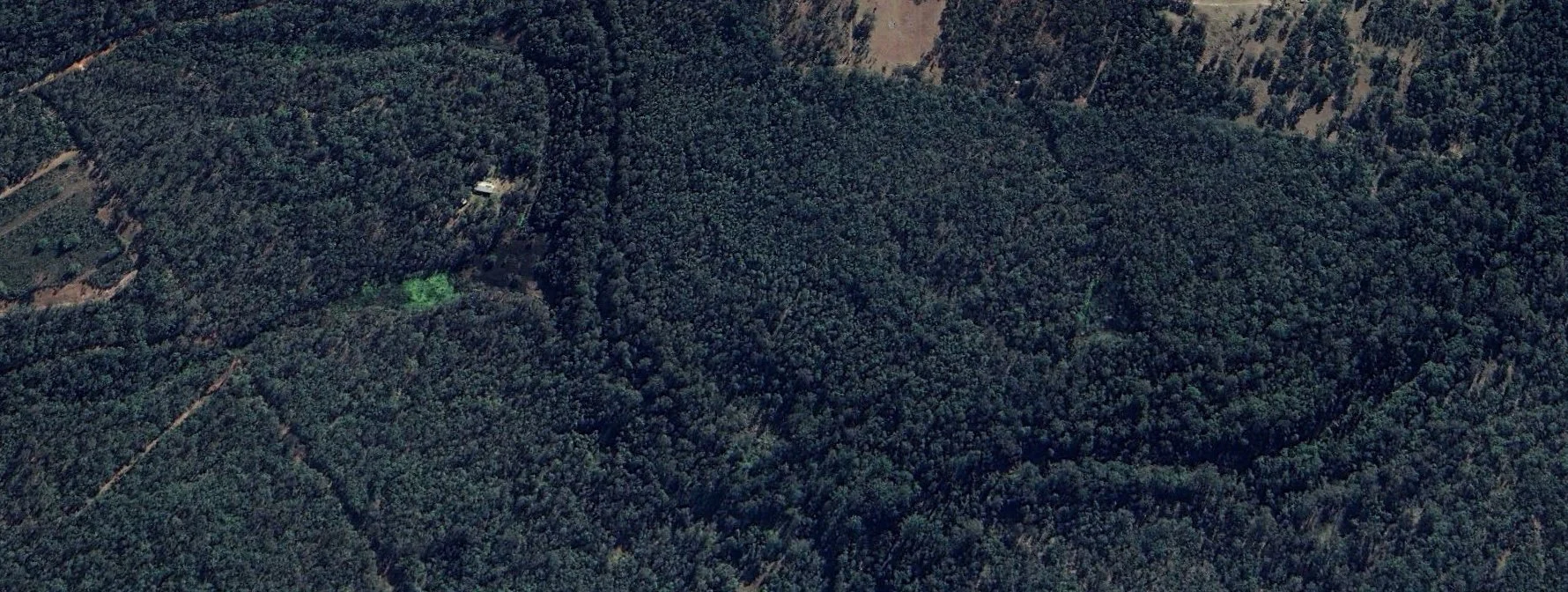
The 2025 satellite photo above shows the area completely covered in vegetation. The creek is just a dark line as the vegetation has spread, grown and shaded the creek bed.
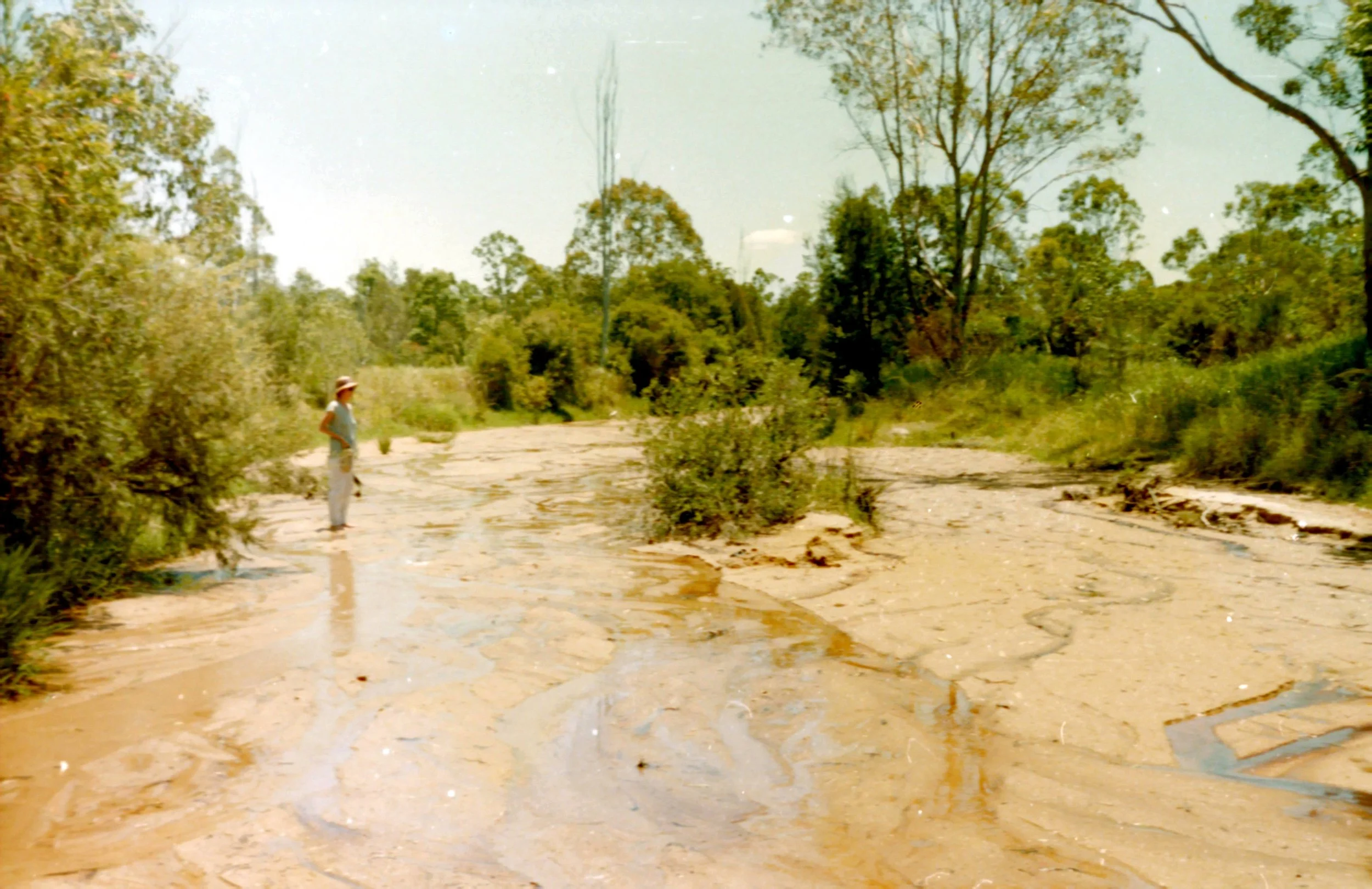
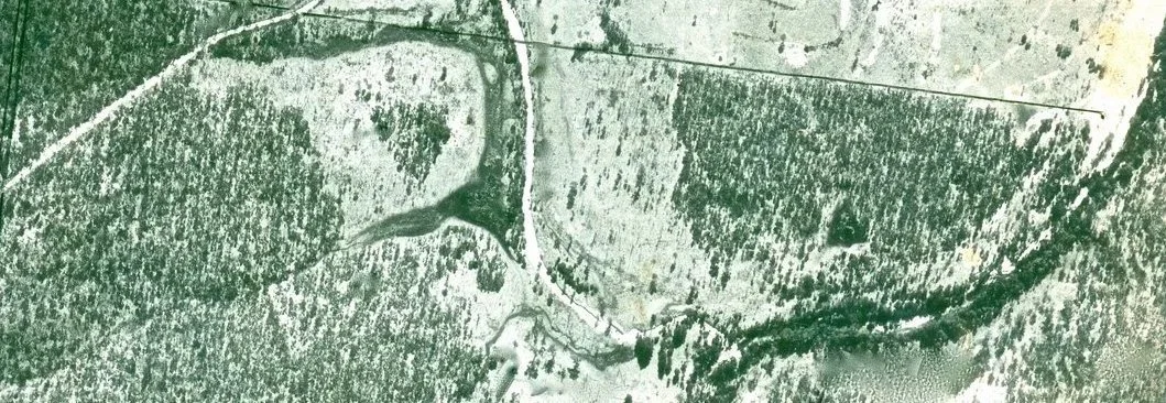
White Swamp Creek 1985 showing the width of the creek and lack of trees
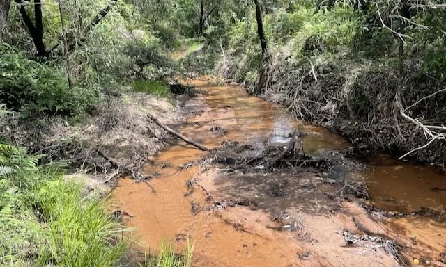
White Swamp Creek 2025 showing the creek at the same location as the above photo
Istari
Istari is our home in the Clarence Valley.
The property of just over 60ha was largely cleared as the early European timber getters removed the largest trees then over time was further cleared for dairy farming along the creek flats. The land was too poor to sustain dairy cattle so became marginal beef cattle land.
Cattle and horses were removed in the mid 1980s and the land was able to commence recovery, producing a number of different habitats and growing bio-diversity.
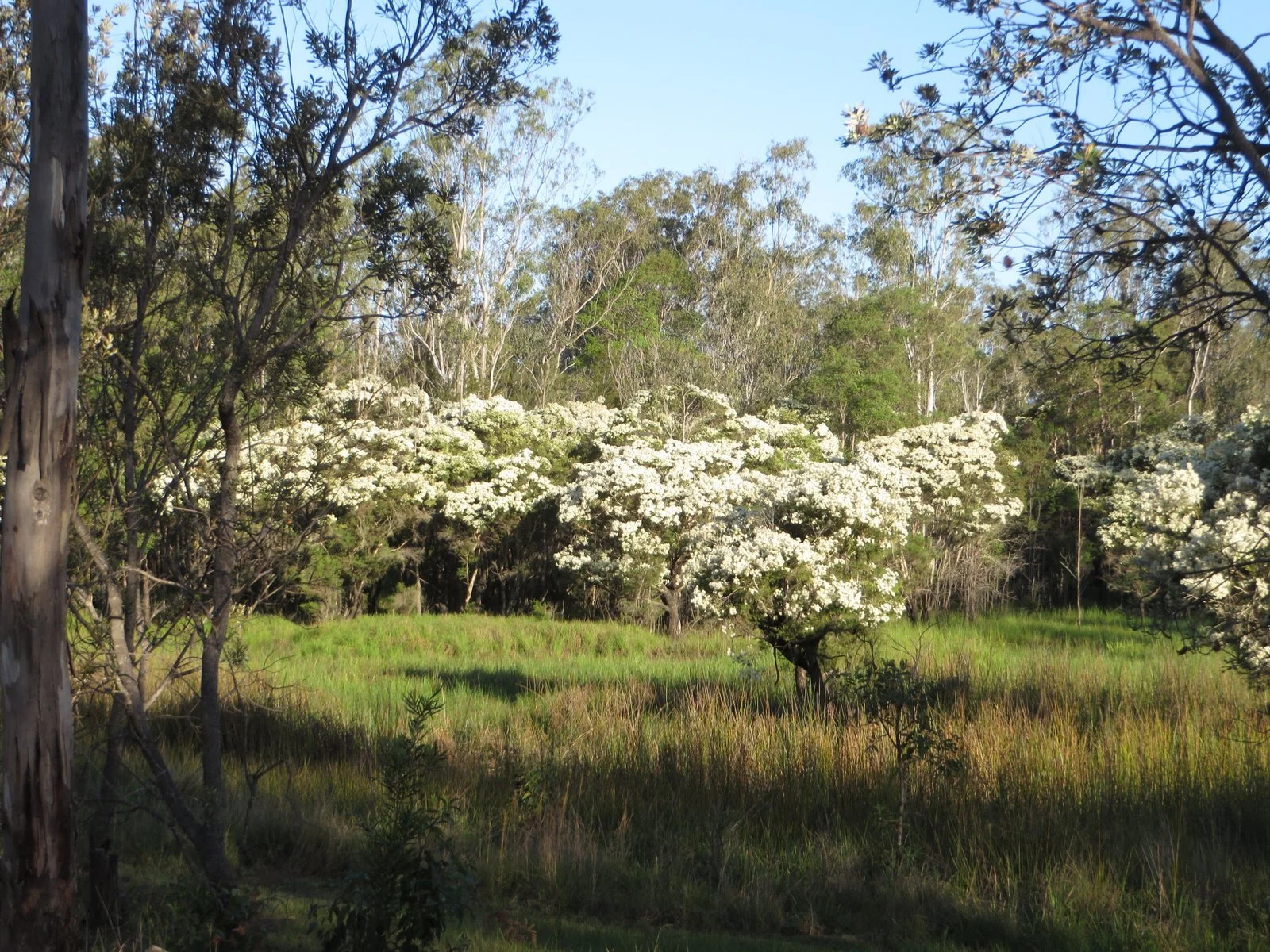
Over time the bush grew back. It developed a variety of habitats particularly wetlands, riparian zones along the creeks and open forests on the hill sides.
We know there are many out there who share our enthusiasm for the bush but not everyone can live among it. We hope by sharing our experience we can build a better understanding of the Australian bush.
As most of the large trees were removed the new forest started to grow. Very few of the trees are more than 40 years old but the regrowth shows what can be achieved just letting ‘the bush grow back’.
We now battle with weeds that came in over the years and even when we have some success removing the weeds as floods regularly occur along the creek flats so do the weeds return. The battle continues.
Friends of Istari
Our Letter from Istari blog gives regular bush updates of life in the Australian bush. We'll introduce you to our local long term inhabitants, like our goanna, Jac, and our wallaby, Mos, and some of those who come and go like the Plumed Whistling Ducks. We'll delve into some of the unique flora and fauna.
Become a Friend of Istari and we'll send you regular updates and let you know when we have something new to show you.
If you would like to use any of our photos within this site please contact us first.
Brought to you by Terry and Ian - Istari residents along with a cast of other local characters.
Istari was purchased in 1984 by Ian Bentley and Ivan Ternovy with a clear aim: “let the bush grow back.”
The bush returned and continues to grow and florish.
Tragically, Ivan died in a motorcycle crash in 1995.
Istari remains not only a conservation site but also a memorial to Ivan.
Vale Ivan Ternovy 1958–1995
Some history of Istari after European settlement
Like many places across the land that is now called Australia the land in the Clarence Valley was logged extensively when first found by British explorers. The extent of logging was enormous taking out all the largest and most valuable logs, like red cedars, first. This opened up the region to further logging and eventually the British settlers arrived and set up communities as they spread across the region, exploiting whatever they could.
Farming began and this required the widespread clearing of the land. Initially this was used as grazing land with the dairy industry growing along riparian zones where there was some nutrient from the regular flooding. Once cleared though this nutrient was depleted and the farms struggled to survive.
The aerial photograph below was taken in 1979.
The extent of clearing is clear especially along the creek, White Swamp Creek, shown as a white ribbon running from top to bottom. There are no trees along the creek. The creek itself is a wide shallow sandy creek.
When we purchased the property in 1984 that stream had not changed.
iNaturalist
Over the years we have prepared lists of flora and fauna, often incorrectly or with a lot of problems identifying species. We managed to find some amazing people who helped with identifications.
Today we use a wonderful platform, iNaturalist. Here we load up photos and literally have a world of experts identify each species. We highly recommend its use.
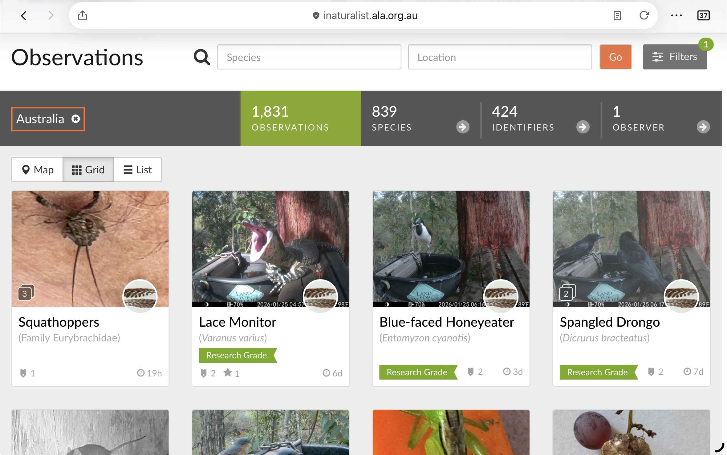
If you would like to see a list of our observations you can go to
https://inaturalist.ala.org.au/observations?user_id=istari
Or go to inaturalist.ala.org.au and search for “Istari”